We love altitude records here. Lake Titicaca is the highest navigable lake in the world at 3,800m, but I’ve been to Lake Qarakol in Tajikistan at 3,950m and I reckon you can drive a boat on that.
Back to the lake in question. Lake Titicaca is the largest lake in South America. That is unless you count Lake Maracaibo which is much bigger, and also a lake
Lake Titicaca is a lake. It’s divided between Bolivia and Peru. We visited both ends and will be able to give you the lowdown on each.
Some actual facts about lake Titicaca:
- It’s freshwater: crystal clear yet terribly polluted
- Full of invasive trout
- Has man made floating islands
- Source of the founders of the Inca empire
But is it worth a visit?

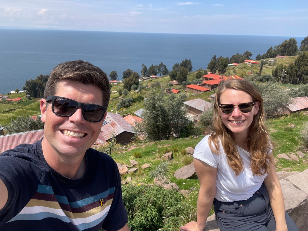
Isla del Sol
Our taxi driver to the La Paz bus terminal only ran three red lights. It was morning rush hour, but that didn’t matter.
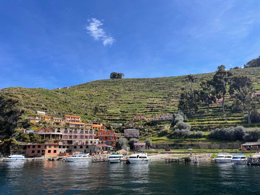
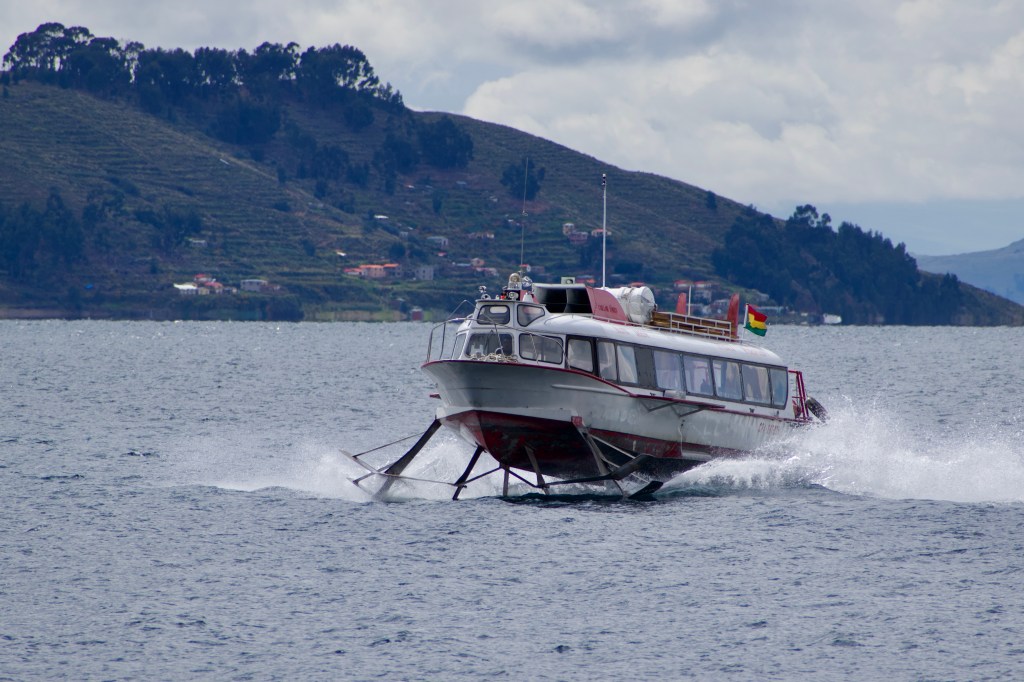
By lunchtime we were in Copacabana on the shore of Lake Titicaca. From here boats depart to the Isla del Sol, the largest island on the lake.
We quickly secured an onward bus ticket, luggage storage, and a passage to the island. Which was fortunate because Copacabana really wasn’t all that. All that was on offer was a couple of dirty streets lined with restaurant touts, money changers, and souvenir tat sellers.
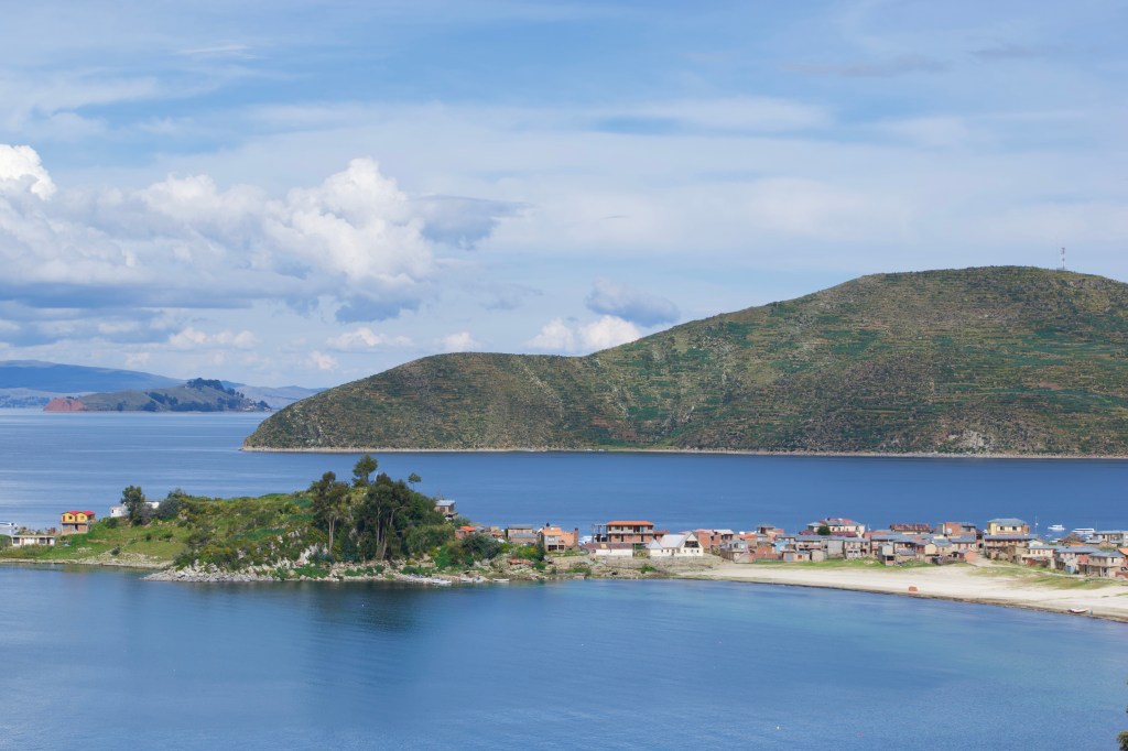
Isla de Sol is split into two. There is a north, and a south. Fairly recently it was impossible to travel between the two, there had been a political fallout involving the murder of a Korean tourist. Luckily the whole island is back open, and you can walk the length of it in roughly 3-4 hours.
Our boat took us to the small village of Challapampa in the north of the island. A very quiet place nestled between beautiful clear blue bays. Landing here at 3:30pm, we had barely three hours before nightfall and hoped estimates of three hours walk to the southern village were accurate.
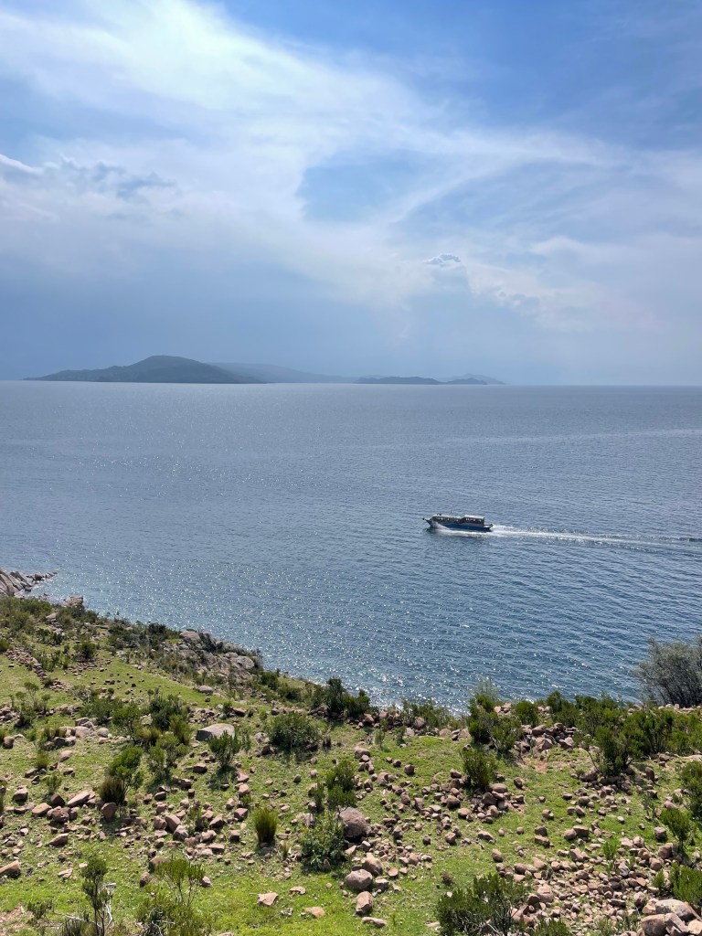
There are no cars on the island, only footpaths, which adds to the sense of isolation. Outside of the two villages we only saw a couple of other people walking.
From Challapampa the path first heads north around the northern tip of the island and some Inca ruins. On the way a couple of local ladies stopped us to sell us tickets to the island for 10 BOB each (£1), and also helpfully pointed us in the right direction.
The path across the island reaches 4,000m, and the gradual climb out of village of barely 200m vertical is a lung busting effort at this altitude.
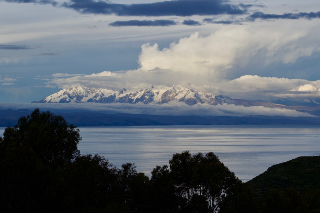
Northern Isla del Sol is treeless, with rolling hills meeting the crystal clear waters of lake Titicaca. The whole scene is reminiscent of an Aegean island without even fewer tourists. The footpath is well maintained and traverses the peaks of the hills marking the spine of the island making for some great views. In the distance across the lake are the snow capped peaks of Ancohuma and Illampu.
Isla del Sol is known as the birthplace of the Inca empire. The mythology is a bit difficult to untangle, but it seems as though the Incan sun god lives here, and the founders of Cusco were born here. For more info go and read Wikipedia.
Three and a half hours later, and just after sunset, we made our way into the village of Yumani. The largest village in the island and perched on the top of the hill. Given we had walked without much of a break, the three hours cited is an optimistic estimate, especially if you have a schedule to meet.
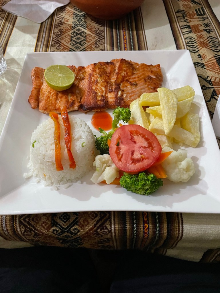
Dinner was trout from the lake, at least for Mike. Sarah had quinoa soup. We had dived into a local restaurant just as a storm broke over the island, and from our vantage point we watched the lightning flashes all over the lake.
Yumani is full of small guesthouses and restaurants. It was far from high season, but it was heartening to see that most places had at least one customer. Our guesthouse for the night was Inti Wasi, and they were more than welcoming as we turned up long after nightfall. They still had mint tea and beer on offer for us, for which we were very grateful.


Entering Peru
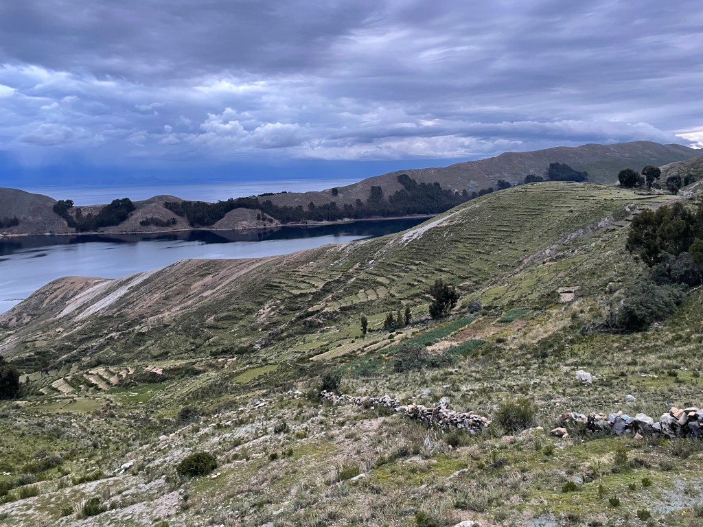
In the morning it became clear quite how high Yumani is perched up on the island above lake Titicaca.
From our hostel we enjoyed great views over the steep terraced steps down to the lake. Despite being at 4,000m, the locals cultivate a decent array of crops on what seems like difficult terrain.
We made our way down the historic Incan steps to the port to catch the 10:30 boat back to Copacabana, and our onward bus to Puno.
The Peruvian border was swift, and by mid afternoon we were on our way around the lake. However some roadworks caused us a 90 minute delay on the way, we made it to Puno just after dark. We had gained an extra hour, which meant in Peru the sun sets before 6pm, which is a stark contrast to when we started in Ushuaia and it was nearly 10pm before sunset.
Puno itself is a large and touristy city. More trout and quinoa soup was easy to find.


Uros and Taquile
The big deal here is the floating islands. Luckily you can’t move for tourist touts trying to get you in a boat to see them.
We booked through our hostel, and at 7:30am we were promptly collected from our door and deposited at the harbour-side where the scrum for boats began. We’ll never know whether we took the correct boat, but at least the tour met the description of what we paid for.
First stop Uros. It’s an extremely touristy endeavour disembarking onto a floating island. Colourfully dressed women shake everyone’s hand, and you are encouraged to greet them in Aymara. First up we were offered a ride on a totoro reed boat to view how the totoro reeds are harvested. School aged girls joined for the ride and sang local songs whilst plaiting the tourists hair. After the boat ride we were treated to an explanation of how the islands were made, and yet another sing song from the islanders. Afterwards we were encouraged to buy colourful hand sewn cushion covers from in front of each of the houses. At the end of the talk the local women rushed in to grab some tourists by the hand and lead them to their souvenir stall. Sarah and I were separated and each individually given the hard sell. It was all rather uncomfortable, and what’s more in the end it’s unclear whether the islanders actually live on this floating platform, or whether it’s all a show.
Now that I’ve hastily described the contrived tourist activity, we can discuss the quite fascinating set of circumstances which brought the floating islands into existence in the first place.
Two major theories abound. The first – the locals were fisherman and hid in the reeds when the conquerors came (Incas most likely), they wanted to avoid working on the land, but also death and ska were. Upon hiding amongst the reeds they realised they floated, and they could build houses and be free from invasion. (The Incas were notoriously non innovative – having never developed a wheel). The second theory is that the islanders are Polynesian immigrants adjusted to a life on the open seas. Either is a great tale to spin tourists.
Taquile is very similar to the Isla del Sol. The Aymara inhabitants care not for the international border. Taquile sees more tourists though, so we were treated to some terrible traditional dancing in order to extort cash from the fifty or so tourists present. We had a nice trout lunch with quinoa soup, and enjoyed the incredible vistas across the seemingly endless lake. It really was a stunning and peaceful location, so of course some twat had a drone.
The ride back to Puno was two hours sailing through a thunderstorm. We spent the evening souvenir shopping and avoiding restaurant touts before it was time to embark on our Transzela nightbus to Arequipa.
Transzela was decent enough, during boarding the police reassuringly took everyone’s passports out of sight. Usually a terrible error, this time it turns out they were real police and we got them back.


- The infamous Binga-Karoi road
- Mana Pools: A bucket list location?
- Camping Among Lions: Chitake Springs Experience
- Chirundu: The worst border in the world
- The Wild Dogs of Jeki: Sunrise in Lower Zambezi

Leave a comment